OpenAerialMap
- date:
2010-06-06 18:57
- author:
admin
- category:
general, opinion
- tags:
data, openaerialmap, osm
- slug:
openaerialmap
- status:
published
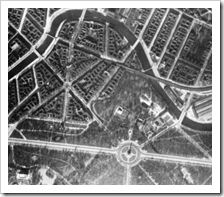 Everyone loves aerial photography. Some of its early
pioneers
were the James Bonds of their era. Twenty years ago people could go
round neighbourhoods in England and sell people frames photographs of
their houses from the air.
Everyone loves aerial photography. Some of its early
pioneers
were the James Bonds of their era. Twenty years ago people could go
round neighbourhoods in England and sell people frames photographs of
their houses from the air.
Today people spend hours looking at the aerial photography layer on Google Maps wondering why so many people have outdoor swimming pools in the UK..
People also like free data. And companies like data free from the Google Terms of Service even more. The successful OpenStreetMap wiki refers to what seems to be the perfect datasource - the OpenAerialMap (OAM) project, however it starts with the rather ominous opening statement:
It was available at *http://openaerialmap.org/* but…
The reasons for its demise are documented by Christopher Schmidt (a major force in the development of OpenLayers and TileCache) in this post to the mailing list. In summary the main reasons for failure were technical - dealing with the huge amounts of raster data and getting disk space.
Cedric Mouillet asked on the mailing list what was the state of the project, to see if it could be used as reference mapping for the OpenAddresses project. No answers were posted.
There is still however life in the movement. A conference call was made at the start of May 2010 to discuss the hardware set-up of the project. Included in the attendees list for the call and on the OAM Steering Committee are members of OSGeo which may prove critical to the future of the project.
Anyway here’s hoping to a successful second version of OAM. In the meantime Google’s aerial photography service (followed by Bing and Yahoo) will remain way out in front terms of data quality, quantity, and ease of access. Just remember it is only “free” in one sense.
- orphan:
Comments
Add Comment